Maps
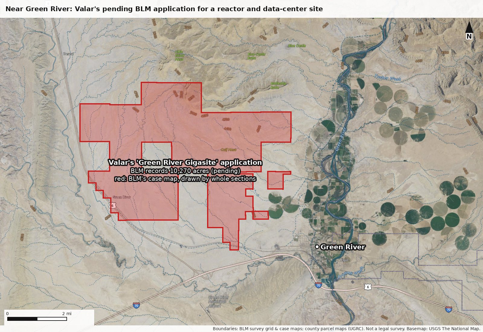
Where each site is, and how big, on maps drawn from official boundary data.
Every outline is drawn from official boundary data: the BLM survey grid, county parcel maps compiled by the state, and BLM's own case map. They are accurate to the tens of meters those datasets carry; they are not a legal survey. Basemap: USGS The National Map (public domain). Tap a map for full size.
Every project
DOE-authorized; reached zero-power criticality June 18, 2026; its safety papers describe a 12-month test.
Emery County approved selling it to Valar for $394,500 (records disagree on whether the sale closed); Valar told the county it wants it for fuel fabrication and manufacturing; Orangeville is drafting a zone to annex it.
Lease approved Sept 17, 2026 for a nuclear, fuel and industrial campus, up to a century, with the right to buy; nothing built, no county permit filed.
A posted notice dated Sept 12 names Valar as locator; the land is zoned rural residential; the county copy is due about Oct 12 and the BLM filing by Dec 11.
Pending with BLM as of Sept 29, 2026; Valar told a reporter it applied only for survey access and has decided not to pursue it.
A second pending BLM application by Valar for a reactor and data-center site; no location is public.
Altigen JS, LLC's permit is before the Carbon County Planning Commission on Oct 6; the developer's stated plan is gas-fired power plants; no record links it to Valar.
The maps
The region: Valar's sites and proposals in Carbon and Emery counties, with nearby state permit applications
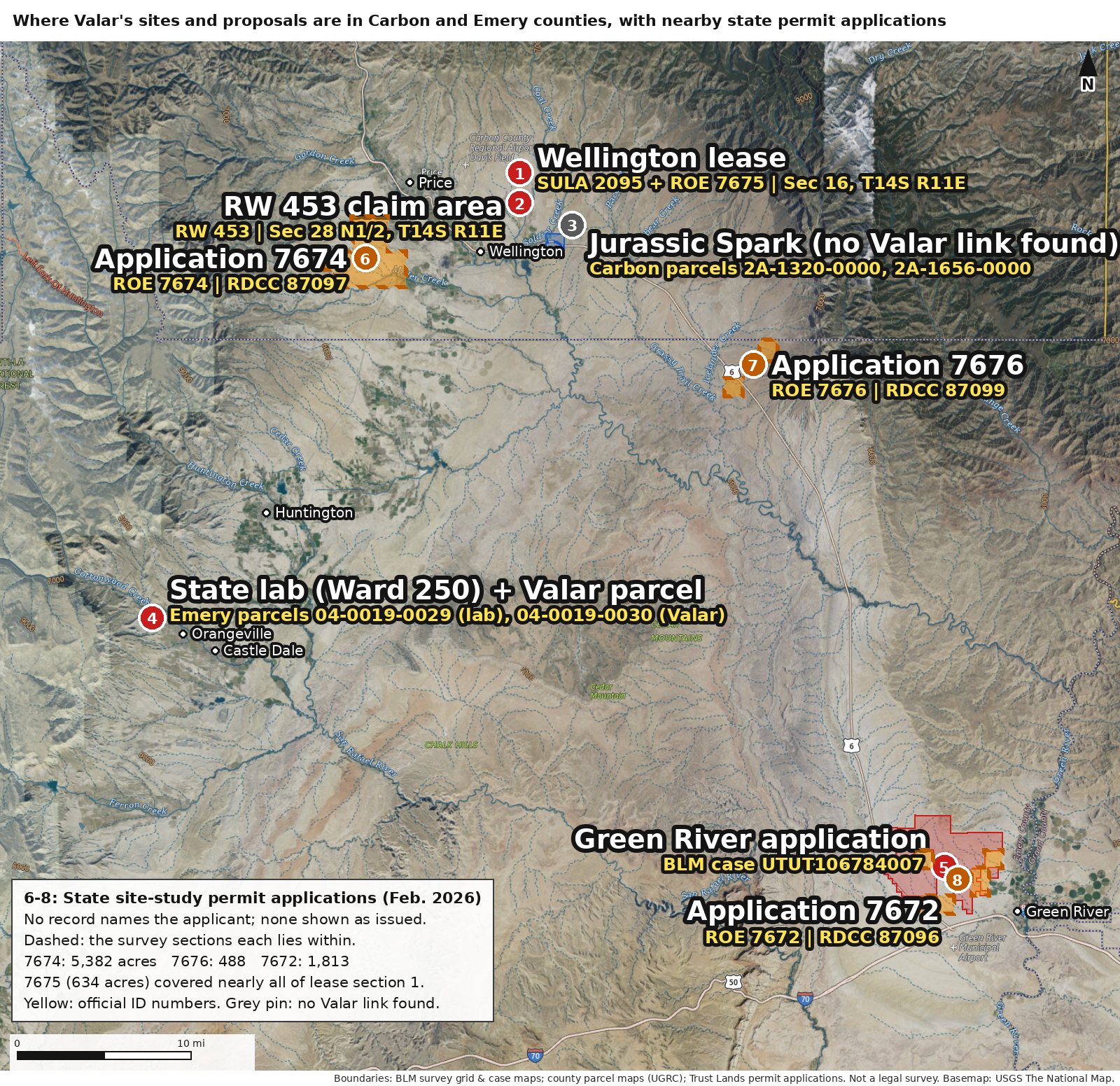
North and east of Wellington: the lease approved for Valar, the RW 453 claim area, and the Jurassic Spark site
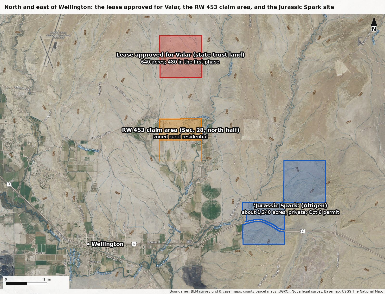
Orangeville: the state lab that hosts Ward 250, and Valar's land next to it
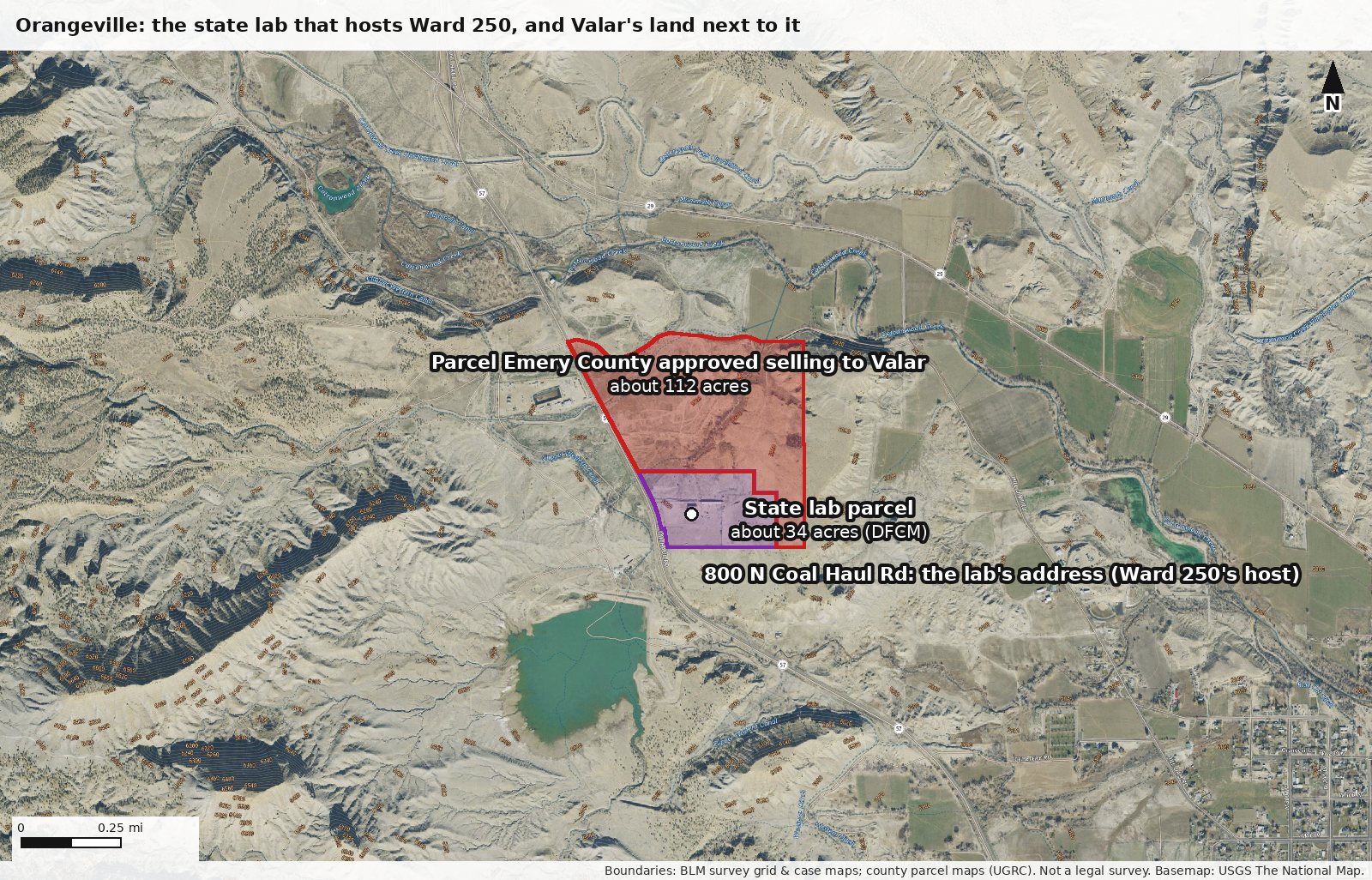
Near Green River: Valar's pending BLM application for a reactor and data-center site